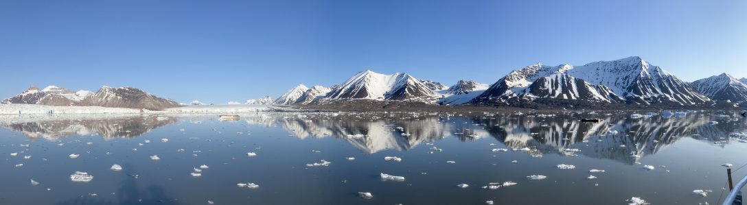
Greenland continues to make the news this year, although this most recent time around for reasons of geography rather than politics. Last month, it was reported that an apparent small island was discovered off Greenland’s northern coast which, if confirmed, would make that particular patch of land the most northern island in the world.
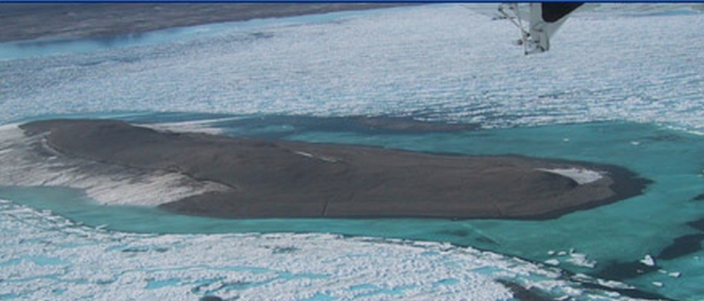
The island in question, which has been given the provisional name Qeqertaq Avannarleq, (Greenlandic for ‘The Northernmost Island), was originally estimated to be barely sixty by thirty metres in size, and approximately three to four metres above sea level. The island has no vegetation, but rather mud, silt and sedimentary deposits from surrounding ice floes.
Once the island’s status has been confirmed, it will dethrone the two previous candidates (both also located off the coast of Greenland) for the ‘northernmost island’, namely Kaffeklubben Island (Inuit Qeqertaat) at latitude 83º39’45”N and Oodaaq at 83º40’N. Oodaaq had been discovered in 1978 by a Danish survey team off the coast of Greenland island’s own northernmost point, Cape Morris Jesup. For contrast, the northernmost point in the North American Arctic region is Cape Colombia, on Canada’s Ellesmere Island, which is situated at 83°06’41”N.
As with many like discoveries, this find was accidental. A Swiss-Danish scientific expedition with the Leister Expedition Around North Greenland 2021 project, was surveying the area in July of this year when the five-person contingent made a stopover [in Danish] on what was originally thought to be Oodaaq to collect samples for bacteria testing. The group was interested in whether the island had been created [in German] by an ancient moraine and further shaped by ice and wind.
It was only after the team left the region that it was discovered, due to an initial GPS error, that they had landed on an islet which was roughly eight hundred metres northwest of Oodaaq’s location. It has been suggested that the reason why the island had not been previously detected was that it had only been recently uncovered due to shifting ice in the area, (although not by climate change).
Greenland has been the subject of intensive scientific studies of late, including in relation to climate change, due to the country’s ‘front line status’ in observing the effects of Arctic ice loss. The Greenland ice sheet (in Greenlandic, Sermersuaq), covering approximately seventy-nine percent of the country’s surface area and possessing an average thickness of three kilometres, has demonstrated signs of accelerated melting, and may be already reaching a tipping point.
During July of this year, record levels of rainfall on the ice sheet were observed, further illustrating the effects of climate change in the region and fostering further debate on what the erosion of Greenland’s ice would mean for the planet.
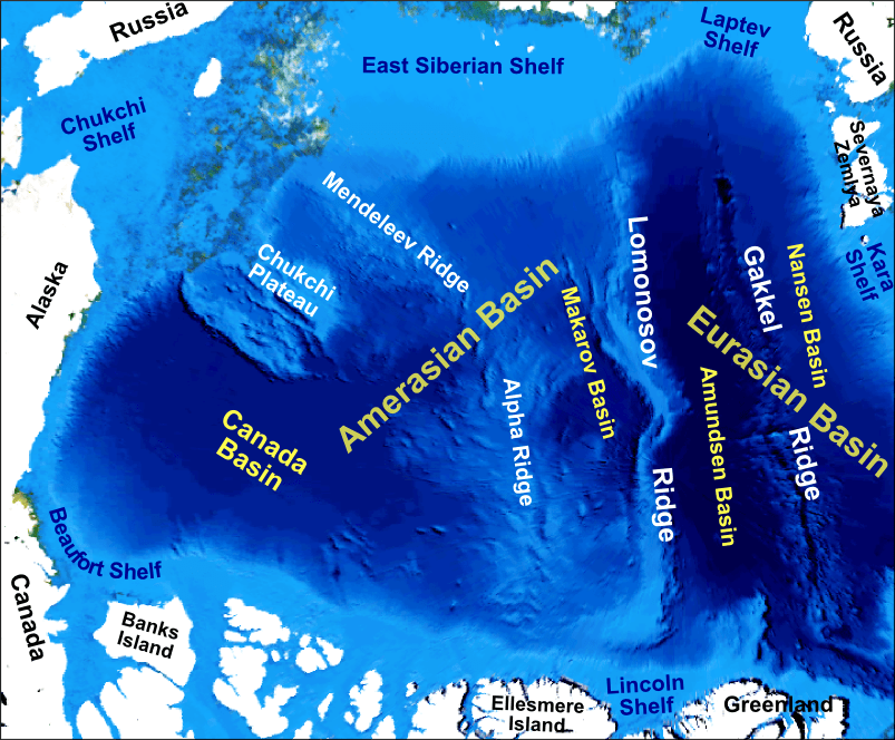
If this new island is proven to be a permanent feature, there may also be implications for Greenland’s northern maritime boundary, which has been a complicated diplomatic subject given the disagreement between Greenland, (and the Danish government), Canada and Russia over the status of the nearby Lomonosov Ridge, which all the parties claim as part of their continental shelves.
Whether Greenland’s exclusive economic zone (EEZ) will need to be adjusted due to the discovery of this island will depend on whether the feature remains above sea level indefinitely, as it is also possible that the island may at some point be submerged due to shifting ice patterns or storms.
